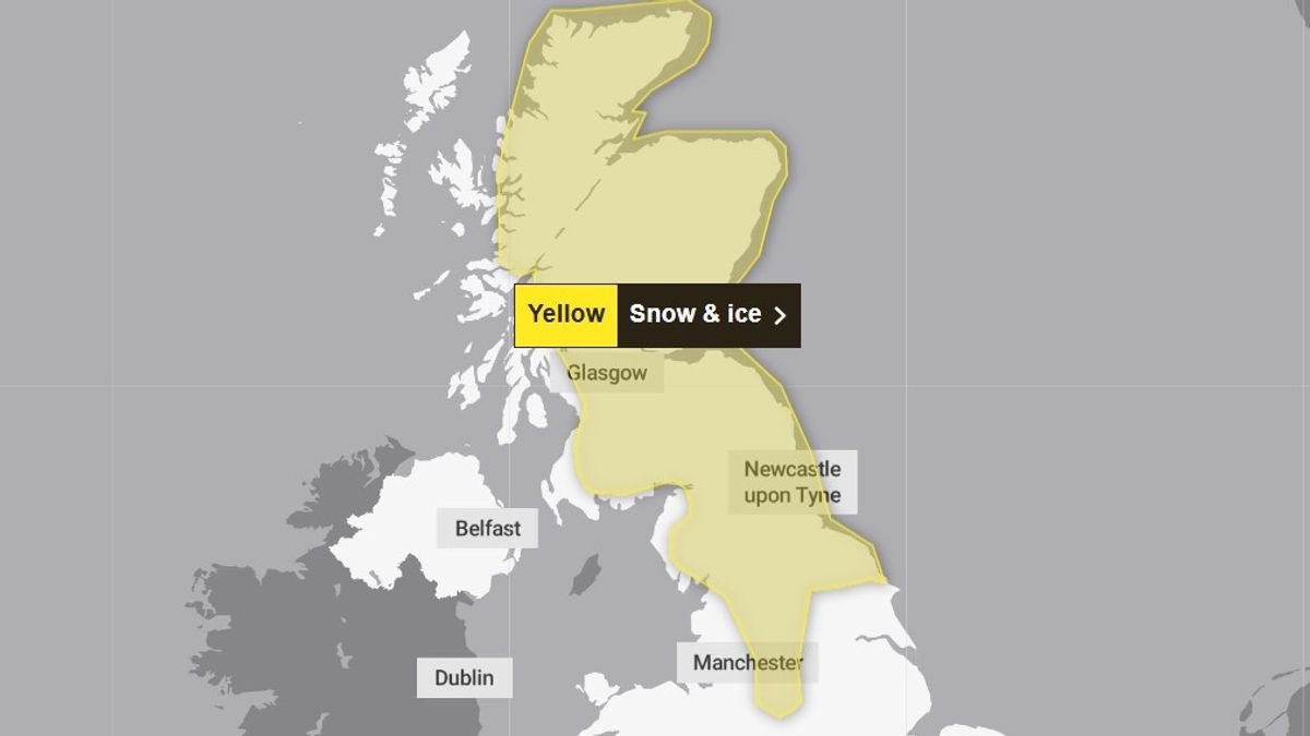


The Met Office has issued a fresh yellow warning for snow and ice on Sunday as individuals across the UK grapple with the aftermath of Storm Goretti.
Storm Goretti brought gusts of nearly 100mph following a rare red warning for hazardous, stormy winds in the South West. Over 30,000 properties experienced power outages in the South West by around 5:30 PM on Friday, as reported on the National Grid’s website. In addition, approximately 3,000 homes were affected in the West Midlands, over 900 in the East Midlands, and around 160 in Wales.
Ongoing weather alerts are in place for the weekend, with a predominant risk of ice across most regions, according to the Met Office. A new warning for snow and ice has been activated for northern England and Scotland, from 2 AM to 3 PM on Sunday.
Meteorologists anticipate snowfall causing disruptions, potentially leading to travel delays on roads, stranding vehicles and passengers. The weather service cautions that travelers using rail, air, or bus services may encounter delays or cancellations.
There is a potential for injuries from slips and falls on icy pathways, alongside the risk of power cuts. Explaining the new weather warning, the Met Office mentioned, “A band of snow is expected to sweep across the warning area through Sunday morning. In northern England, this will be primarily above 200 meters, but in Scotland, snow could fall at lower levels in the morning before concentrating at higher elevations later in the day.”
Forecasters added that the snow accumulation will vary based on elevation and precipitation intensity. Affected areas include parts of Central, Tayside and Fife, East Midlands, Grampian, Highlands and Eilean Siar, North East England, North West England, Orkney and Shetland, South West Scotland, Lothian Borders, Strathclyde, West Midlands, Yorkshire and Humber.
Snow and ice warnings are also in effect on Saturday, with Met Office Chief Forecaster Steve Willington stating, “Following a predominantly dry Saturday except for northeastern regions of Scotland and England, a westward front on Sunday will bring snow to parts of Scotland and northern England, with low temperatures continuing to pose an ice risk. An additional 2-5cm of snow accumulation is probable in low-lying areas within the warning zone on Sunday, with 10-20cm possible in higher altitudes.”
Described as a “multi-hazard event” by the Met Office, Storm Goretti, named by French meteorologists, has resulted in outbreaks of rain and sleet gradually diminishing across eastern England. Clear skies and wintry showers prevail elsewhere, with frost and ice forming widely overnight. Winds are expected to subside especially in the eastern regions.
Eastern England and Scotland may experience some wintry showers, while other areas remain dry with variable cloud cover, expecting frost that may linger throughout the day. Winds are anticipated to be calmer compared to recent days.
More wet and windy weather is projected to move eastward on Sunday, with hill snow anticipated in the north. Conditions may also be windy. By Monday and into Tuesday, milder weather is forecasted for all regions.